Thursday, December 29, 2016

Christmas on the Beach

On Christmas Day, while walking on the snow-white sandy beach in 80 degree weather - we came upon these two snowmen who were lounging in the warm sunshine.  Did they really think they could lie out in the Florida sun and not melt?  Did they also mistake the sand for snow?   Didn’t they ever listen to “Frosty the Snowman”?   What was to become of them?


On one of our exploration ventures we found a road that took us out on a guardian peninsula that protects the harbor and all the moored vessels in the bay.  Mansions line the narrow roadway but at the end of it is a long narrow sandy public beach dotted with scrub and clumps of sea oats and a heron that thought he was invisible as long as he stood perfectly still.  The opposite side of the beach is the gulf and a tall white dune of sand separates the two.  From this vantage point you could see all the elbow-to-elbow vessels backed into narrow berths with their sterns up against the long wooden boardwalk.  On one end of the boardwalk was the multi layer shopping area with the normal tourist tee shirt shops, a mammoth resort, and a handful of restaurants and bars.  A lighthouse, a pirate ship, zip line towers and palm trees strung with lights complete the collection.


We returned to the Harbor Walk Village side of the bay as the sun was setting and the lights on the docks were starting to slowly illuminate the pathways. We came across this beautifully preserved and painted tree and had to read the large historic sign posted near it. It had once been a 40-foot Magnolia tree that was over 100 yrs old.  In honor of Captain Leonard Destin, it has been preserved and carved with all kinds of sea life.  Double click and see how many creatures you can find.  See the swimmer with his long black flippers?  The eagle?  The other side also has a large sea turtle and sailfish!


Reminiscent of the Christmas Parade, the local pirate ship and tourist ferryboat were still decorated for the holidays and their multicolored lights danced on the now dark waters below as they quietly rested at their mooring.

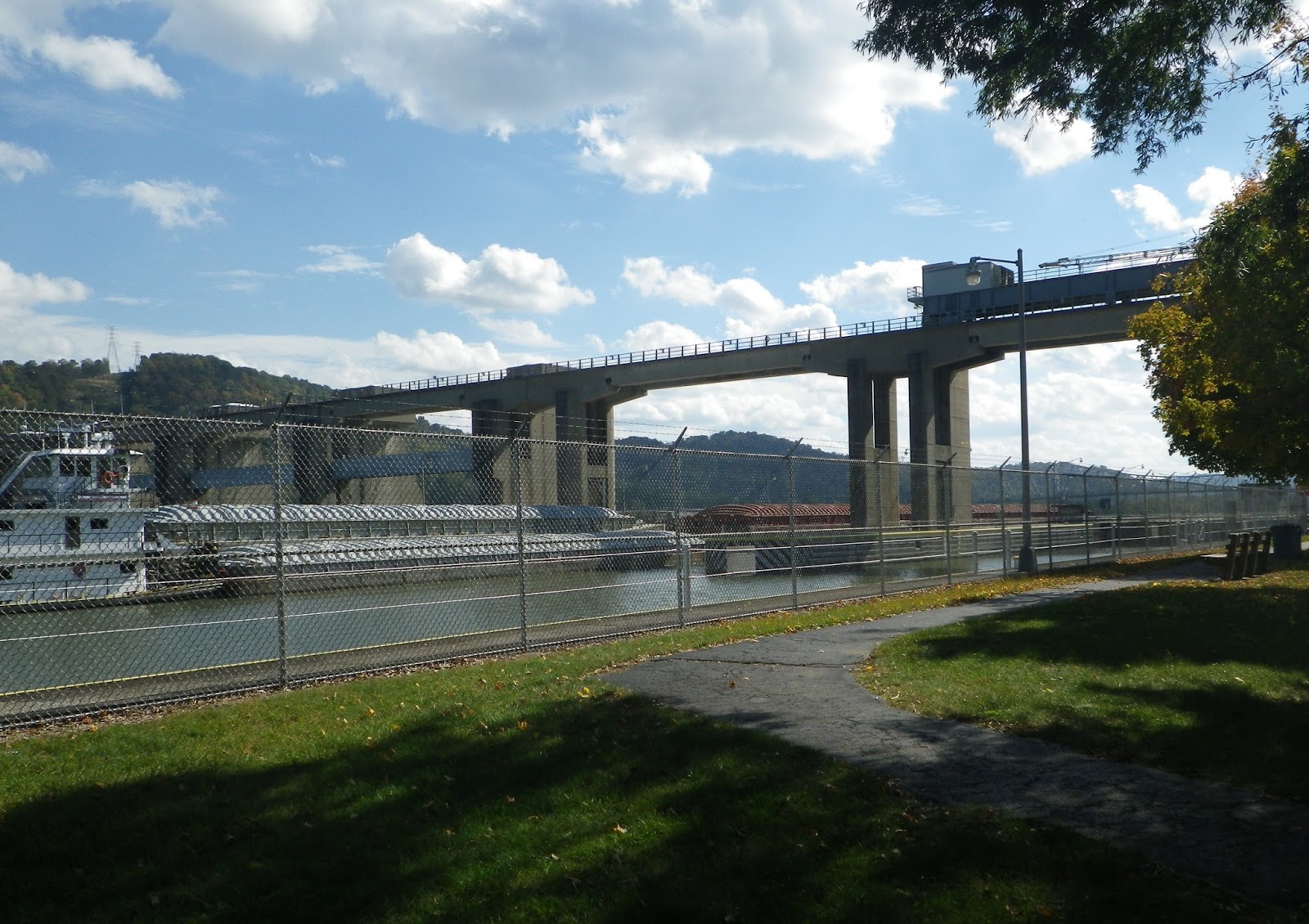
Pleasure boats were returning to harbor and seabirds where heading for their roosts as the sun settled into the clouds on the far horizon on the distant side of the silhouetted bridge that connects the Oskaloosa barrier island to Destin.


The Christmas Season is in full glory at the Bass Pro Shop and the adjoining modern mall that surrounds it like a village!   Topiary reindeer line the streets, music fills the air and the highlight of it all is the tall, wonderfully decorated Christmas tree in the center square!  A colorful child sized train chugged from one end of the mall area to the other, carrying its small sized passengers as it traveled along.


OH, by the way – H has instructed me to assure you all that he has rescued the melting snowmen and they are being iced down so they will survive to spend another Christmas Holiday with us!!!  COOL!!


We’re hoping your Christmas was blessed and your expectations were fulfilled.

Stay with us – we’re moving again! 

Thursday, December 22, 2016

Gulf Shoires to Destin

This may not be one of “THE” Blue Angels but this island also has plenty of these blue Herons!!!  We were walking on the beach and the fishing pier on the bay side of the island and this big fella kept moving out in front of us.  He finally took off just as I snapped this photo!!  He’s flying – and he is blue!


One clear day we chose to try and get closer to the Blue Angels since I was not able to catch them as they roared over our
campground.  We left the island and headed for the Pensacola Naval Station – just in case they would be flying while we were in their neighborhood!  No luck but as in our last trip to this area we did find the Pensacola lighthouse.  It was all decorated in Christmas wreaths and garlands!  The lighthouse sits high on a hill right across the
View of  Fort Pickens from across the bay
bay from “our” island and Fort Pickens.  Zoom in on the picture and you can see the fort and the white sand on the island’s tip.  As the crow flies it’s about 3 miles but by GPS it’s more like 25 miles by road!!    The lighthouse shows up much better while standing on the warm sand on our island while the waves from passing boats splash up on shore.
Pensacola Lighthouse from Ft Pickens

After we first arrived on the island and once all the rain had stopped and the flooding had dissipated, we could see a large black hulk lying on the sparkling white beach at waters edge.  The powerful salvage vehicles had finally been called and the huge skeleton of the shipwrecked vessel had been turned over and drug up to the
road’s edge – causing the newest traffic bottleneck by gawkers wanting a better look  - or maybe a picture?!  


We strolled thru the Civil War part of the Fort once again (SPFB!) and the limestone secretions were still there and maybe the stalactites were getting a bit longer as they clung to the damp roof of the ancient arches.   We found more WWII batteries outside of the thick brick walls of the original fort and climbed up their steep black steps to view the gray clouds that were covering up the sky that day.

Our other new friends, Richard and Rachael moved out on Saturday to get ahead of the next predicted thunderstorm and we finished packing up to head out ourselves on Sunday.  I would love to hear from both of my newly gained Alabama girlfriends again!

As we drove east along the entire length of the Gulf Seashore Island, it had a light covering of misty fog.  Heavy charcoal clouds hung out over the gulf and showed streaks of rain alternating with bands of sun.  We exited the island at Navarre Beach and must have been the only ones to have noticed the rainbow’s colorful bands against the cloudy sky as the light rain drops fell and the sun burst thru over the gulf!


Henderson Beach State Park is east of Fort Walton Beach, another barrier island bridge and touristy Destin.  When we stayed here 10 years ago on our way to Texas, the road out front was a quiet 2-lane road with just wind blown dunes and a solitary Wal-Mart across the
road.  Now there are towering condos and resorts lining each side of the fast moving 4-lane highway.  The harbor has a boardwalk that stretches the length of shops and restaurants - from the bridge’s span to the distant end of the scrunched together rows of yachts and commercial vessels.  When we were here before it was the winter right after Katrina and I remember several boats moored at the docks were survivors of that horrid storm.   There had been a lighted boat parade that we watched from the boardwalk with all the rest of the folks!  This year we’ve missed it by one weekend.  Drat!   However – like everything else – it has probably grown way too big and way too crowded and maybe not nearly as much fun as before.  That or we’re just getting OLD!!??   Nah, not us!

The campsites and facilities are just as great as we remembered – groomed, private sites and the bathrooms are tiled and heated. 
There is a boardwalk that crosses the rugged dunes like the Great Wall of China but I did not remember it being Sooooo long!!  The cold and wet weather has abated again. The warm sunshine has returned.  Now it’s back to beach walking on the snow white crystal sand with the aqua blue waves lapping at the shore, bike riding and breakfast outside.


On the island off Pensacola we listened to the jets and airplanes that flew from the Naval Station.  In Destin we are just south of Elgin Air Force Base and we get to watch a different crop of aircraft fly over!  More jets, lots of helicopters and we even saw a VTOL!  H said it was a Vertical TakeOff & Landing plane - I called it a cross between a helicopter and a jet!

 Christmas is almost here!  May yours be Merry and Joyous and Bright!

Tuesday, December 13, 2016

Gulf Islands National Seashore


Gulf Islands National Seashore is a series of barrier islands that protect the coastal areas of Mississippi, Alabama and Northwest Florida.  In Texas they also have the Padre Islands National Seashore.  On our first winter’s trip, we blogged about camping on South Padre and also at the northern end of that chain of islands.  See “Previous Florida Blogs” for our last visit here, too!
 
The four inches of rain from last Sunday finally quit coming down but the solitary 2-lane road that leads from the park entrance gate, past the check-in building, and on to the campgrounds was flooded and took 5 days to dry up!  Our campground loop was fairly high and the water drained pretty quickly but the other, larger campground loop did not fare so well!  It’s a good thing that all of the electrical boxes are mounted 4 feet off the ground on tall wooden posts.


We’ve already gone thru the main part of the fort before but on each visit we find more to inspect and learn about.  This time we’ve checked on the World War I Cooper’s Battery that held the disappearing canons.  These canons popped up, disappeared and reappeared like jack in the box!  According to the sign nearby, this battery held 2 6inch rifles mounted on disappearing carriages.  When the guns were fired, the recoil automatically lowered them behind the concrete wall, which protected the crews while they reloaded the guns.  Counterweights then returned them to the firing position.


Flooded park roads did not hold us back from venturing out to explore Pensacola and surrounding areas.  On Pearl Harbor Day we headed back to Mobile and the Battleship Memorial Park where we toured the battleship, USS Alabama and the submarine, USS Drum.   Alabama is 680 ft long and 108 ft wide!  She carried 9 16-inch guns in 3 main turrets, 20 5-inch guns, 48 40mm guns and 52 20mm guns!  Her crew numbered up to 2500!  We followed the self-tour signs thru the lower two levels past the galleys, bunks and even the bathroom area which was what amounted to a long plank w/toilet seats attached
and one long trough underneath. (Ewww!)  While below we also saw the engine room and the room where the HUGE big guns on the top of the ship got aimed.  We saw rows and rows of missiles and the area where the smaller 5” bullets were stored and then placed in a conveyer tube and sent up to the guns above.  On the above decks you could see what her sailors and marines would see – except now it includes the city skyline and the collection of restored military airplanes in the surrounding park area below.


H chose to return to our base via a different route – a ferry boat from Dauphin Island - a barrier island south of Mobile to Fort Morgan Island – another long narrow barrier island on the east side of the bay.   On both sides of Mobile Bay are 2 more restored forts and each faces the Gulf of Mexico and had once protected the mouth of the Bay.   Out in the open water were imposing oilrigs on tall metal legs.   We passed fairly close to one set of two that were joined by a small bridge.  As we rumbled past and approached the commercial channel, our captain had to throttle back and wait for a long slow moving freighter to pass by and head out to the Gulf of Mexico.  Those of us who were up on the observation area of the ferry got an extra bonus when we watched 2 dolphins leap up and out of the water as they chased along!


We’ve met some neat folks – Wanda and Ed are from the Mobile Bay area and filled us in on some of the local lore. We shared a walk on the beach and a gorgeous Gulf Sunset with them.  Another local neighbor is an armadillo who wanders along and thru the scrub bushes behind our “home”! We’ve seen eagles and osprey and have listened to all kinds of little birds that flit from one tree to another!  And then there are the jets that take off and land all day long from the Pensacola Naval Air Station - right on the other side of Pensacola Bay.  This morning we heard an exceptionally loud roar above us and looked up just in time to see the Blue Angels fly over in formation. Before we leave – I MUST get a picture.  IF I am successful – that picture will be the first thing you see on our next blog!
Not Snow

Our daily routine has settled in to riding the bikes, walking the beach, watching for eagles (or angels!) and occasionally driving the 4 miles back up the road past the gatehouse, thru drifting snow and piled up drifts along the road!   Snow?!  Sorry – I meant SNOW WHITE SAND!!  Snow white SAND!  

Thursday, December 8, 2016

Heading South

Thanksgiving is over – the sweet potatoes and pies are all devoured.  All our doctor appointments are completed.  The Ohio State-Michigan football game has been played and the boys in the winged maize and blue helmets let the Buckeyes win again. It’s now December!  The trailer is packed and ready to go!
 
Crossing into Kentucky
Our southern direction has changed from heading southeast to southwest since we’re heading for the Gulf of Mexico first on this trip.  Our journey down and across Indiana on state roads (not expressways) was great and we watched the landscape gradually change from flatland farming with their corduroy textured, harvested fields to gently rolling hills covered with pastures or wooded acres.   Along with all the rest of the Friday afternoon traffic, we crossed the wide Ohio River on one of the multiple spans of the I 65 bridges – so much for the peaceful ride!  Down below, there were tugboats and long narrow coal barges chugging their way downstream on their own watery expressway.
The Natchez Trace

From Louisville thru Nashville we stayed in the middle lane and let the traffic flow around us!  Thru Nashville and finally onto the Natchez Trace – we could breathe again! We slowed down and began to enjoy the ride once more!  No semi trucks and not much traffic at all – just a deer darting across the blacktop and leaping into the brushy undergrowth and a humongous flock of dark black turkeys that thought they owned the road and wanted to play chicken with the big blue truck!  Then the rains came!  And they kept coming for 3 more days!
The Tenn-Tom River

We parked that night in David Crockett State Park, just outside of Lawrenceburg Tennessee.  The town is full of history from the infamous Trail of Tears to the famous folks who called the town home, including Fred Thompson the actor and congressman.  The MOST famous tho, is Davy Crockett himself!   His history and lure permeates every inch of the town and the state park that is his namesake!  The park boasts 2 modern campgrounds, cabins, a restaurant, archery, tennis and Frisbee golf.   There is a museum/grist mill and a covered bridge that straddle the Shoal Creek where Davy once lived, worked and earned the title of Colonel before heading to the Alamo.

Tennessee and Mississippi on the Trace and then off for the last time as we followed more state roads thru BIG sounding small towns of Louisville and Philadelphia to another state park – Clarkco State Park. Another set up and take down in the rain!  This park was easy to get to from Meridian but the park roads were extremely narrow and tall pine trees stood guard at and behind every narrow site and at each bend of road.

It was a comparatively short jaunt across the cotton fields of Alabama to the gulf coast city of Mobile and US Route 10.  Route 10 seemed like one continuous bridge from Mobile, over creeks, swamps and low areas to the Florida border!   As we crossed the bridges from Pensacola to the barrier island of Santa Rosa the skies opened up even further and the watery deluge came in waves of blinding precipitation.  The windshield wipers struggled to keep up!  We later found out that the amount of rain that day set a new record of 4 inches!   Once in the Fort Pickens Campground in the Gulf Shores National Seashore Park, the downpour let up long enough for us to park on site A14, which will be our home for the next week and a half.  That respite was brief however and the downpour returned and continued thru the night.  Our camping loop fared pretty well but the other one did not and most everything except the parking pads and roadway was underwater the entire next day!   

The rain has now stopped and the “exploring” can begin!

Friday, November 11, 2016

Belle Isle Park Detroit Mi.

The calendar may say that summer is over and it is now mid November but the wonderful, warm, sunny weather is still with us and we are taking advantage of every bit of it!  Our flowerbeds are all covered up for the winter and the last of the veggies are out of the garden. New tulip bulbs with their promise of bright spring
Maumee River
colors have been buried deep in the dark earth.  One last trip up the Maumee River in the boat with our dear friends, Bud and Carol and last week a day trip up I 75 to downtown Detroit and out onto the historic and beautiful Belle Isle Island in the middle of the Detroit River.

Belle Isle Park is a Detroit gem and has become Michigan’s 102nd state park.  This 985 acre island is home to a variety of attractions including a nature zoo, the James Scott Memorial Fountain, the Nancy Brown Peace Carillon, the Livingstone Memorial Lighthouse, lots of playgrounds, walking trails, sports fields and 2 marinas!

Our first stop on the island was the oldest aquarium in the United States built in 1907.  This ceramic tiled domed building houses more than 1,000 fish and an extensive collection of Belle Isle memorabilia.

Next we toured the Anna Scripps Whitcomb Conservatory - the oldest continually running conservatory.  This expansive collection included a formal garden, several seasonal floral beds, a lily pond tucked behind an elaborate wrought iron fence, and an awesome view of the tall towers that make up the Renaissance Center in downtown Detroit.  Inside the high glassed in structure were rooms of tropical plants and vine drenched tall palm trees that reached the ceiling above.  One room was filled with desert plants and blooming cactus of all sorts.  Another held ferns and flowers.


Detroit skyline
We tried our best to drive on every road as it wound around the perimeter of the fall colored island with stops on the Detroit side to view the skyline and the bridge that crosses to Windsor Ontario.  On the other side of the island we caught the blues and greens in the reflections of the water across from the carillon. Our final stop on the island was at the Dossin Great Lakes Museum.  After viewing a movie documenting Detroit’s maritime history, we browsed the halls to see all the displays of boats and the history that came 
with them.  We even walked in the captain’s footsteps on the bridge of a Great Lakes freighter in the William Clay Ford Pilot House!  Out of those windows you could easily see the Canadian shoreline!  Outside were even more displays!   “Miss Pepsi” – the first hydroplane boat to top 100 mph had her own glassed in display!  There were cannons and anchors also - including the original anchor from the Edmund Fitzgerald!
Windsor Ont. Ca. across the River 
All of this activity made us hungry so we crossed from Detroit to Dearborn and went to Buddy’s Pizza for the BEST pizza we’ve ever found!  If you go – try the “ Henry Ford”!   Ground beef, SMOKED bacon, red onion and Blue Cheese - all on a multi grain thin crust!!
Now we must find time to plan for Thanksgiving and then pack for Florida!  The weather will surely be colder by then!

Thursday, October 27, 2016

Hocking Hills Ohio

Hocking Hills State Park was our 3RD and final stop on our Fall Color Trip.  What a Grand Finale to an already beautiful trip!   The campground sat sprawled on several lengths of the high ridge and there were just 5 sites available when we arrived.  Again – it was only Wednesday!  The folks to the right of us who pulled in just after we did were from Texas and the folks on the left were from Florida!  They both pulled out the following morning to continue their separate journeys and were replaced by folks from Delaware and fun folks from Columbus!  Every day there were trailers moving in and out!
 
Life size mural in Circleville
H rolled his decision dice and we headed for Circleville to revisit the 120th Anniversary of the World Famous Pumpkin Show.   Each time that we have visited this festival it has grown bigger and bigger.  Now it takes up most of the entire downtown area.  The mammoth display of every variety of pumpkin and squash and gourds took up one entire block with a Pumpkin Tree in the middle.  If you look past the tree in the photo – you can see the huge blob of pumpkin that won the 1ST prize, weighing in at over

1500 pounds!  Amusement park rides filled up several blocks on each end of the display.  Then there were the row upon row, block after block of pumpkin donuts, pumpkin waffles, pumpkin chili and pumpkin pizza vendors!  The newscasters on TV had been touting the deliciousness of these treats and we had to try the waffles – then wished we had chosen a donut instead!!   Rain had also been forecast but it held off till we were on our way out of town.   After that, it rained for the entire afternoon, that night and all the next day!  On Saturday, when the deluge had finally ended, we headed for the caves and gorges of Hocking Hills!
Old Mans Cave


Hocking Hills is located on 2,356 acres and has gained an international reputation for its impressive waterfalls, gorges, vistas, bountiful wildlife and recreational opportunities.  There are 6 non-contiguous natural areas in this diverse park.  We ”hiked” 3 of those 6 - Old Man’s Cave named for its early 1800’s occupant, Cedar Falls which pumps the greatest water volume of the Hocking County waterfalls, and Ash Cave, the largest recess cave east of the Mississippi River.
 
Ceder Falls
These old folks are worn out now!   Our old legs are not used to that up and down all those steep stairways and rocky pathways!  It’s time to head home.  It’s time to prepare for this winter’s voyage.  That time will come soon enough!  See you then!
Ash Cave

Friday, October 21, 2016

Autumn Color Tour

Pleasant Hill Lake
“Another Time” has arrived.  Time to depart!   We thought the truck and trailer was all packed but after we pulled out, H thought of something important we forgot so – around the block we went!   The sun was shining and traffic was fairly light on the expressway around town so we finally got started on this “Fall Color Trip” to and thru sections of southern Ohio -starting in Loudonville and the Mohican State Park.   In Ohio and Michigan there are pumpkin, apple and Halloween festivities ALL month long.  He thought that we’d have no trouble getting a site since we were arriving on a
Wednesday and not Friday.  HA  - they fooled him - It was their Halloween Weekend coming up and they were already full!   So were several other nearby campground/resorts.  Those that weren’t full – weren’t worth staying at so we left Loudonville and headed around the other side of the reservoir to Pleasant Hill Campground.

Pleasant Hill is not a state park but belongs to the Muskingum Watershed, a flood control group that oversees the local rivers, the dam, the resulting reservoir and the land surrounding them.  The campground does not have organized activities and no campwide Halloween decorations so it was a much quieter stay!  Our trailer is decorated tho!  On the front jack, sits a large gourd with purple bat wings and goofy head.  A stick on purple and black witch clings to the side of the kitchen slide, greeting us as we climb the steps to the trailer! A flat styrofoam pumpkin looks out from the kitchen window.  A jack-o-lantern lampshade has replaced the plain one on the dining area table lamp.  A plastic blow up pumpkin grins out the big back window!
Halloween at Mohican State Park

 Back at the state park there were a plethora of families, with their sites loaded with fake tombstones and blowup ghosts and goblins – each hoping to win a prize. The campground hosts even got in on the festivities and decorated one entire corner with cobwebs, talking ghouls, witches and skeletons.  Some were seated in various camping scenes.  Two were fishing in an empty ditch and three were even floating down that empty ditch in their innertubes!  In town, the quaint streets were festooned with pumpkins, cornstalks and bright fall flower plantings. We shopped our favorite shops and even toured the local history museum.  H was quite taken with the big display on the company “Flexible” which made the first motorcycle sidecar that had an axle that actually flexed when going around a corner.  The company went on to manufacture intercity buses and ambulances and had several factories in town.   “HAD” is the operative word!

From that area we continued our fall back roads color tour down and over to Rocky Fork Ranch Resort with a stop at Roscoe Village and Coshocton on the way.  The restored historic canal town had plenty of folks wandering in and out of the small era type shops and the weather cooperated perfectly!  The colors on the hillsides were really starting to pop!

Rocky Fork “Ranch” occupies a small green valley where the guest area and the horse barns are located and several “mountain” ridges where the actual campgrounds and the recreation center are.  We pulled in on Saturday and were just in time for the 3RD of their 4 Halloween Weekends!   All the little ones and teens were kept busy with trick or treating in the afternoon and in the evening was the costume judging.  The adults held their golf cart parade and late evening dance!  Sunday was the grand exodus as they all pulled out and left the place almost empty! 
Winding narrow roads

Our days were filled with exploring the narrow, winding back roads that connected all the small towns.  Once we drove right thru a muddy farm complex with free roaming chickens in the middle of the road.   
          Up the road (or down?) we spotted a deer by the side of the road.  She didn’t move as we slowly stopped near her.  Perhaps she thought it was just a big smelly blue cow talking to her - since we had just driven thru the muddy barnyard and the farmers were spreading manure in their fields (and on the road?).   One skinny road wound down and around to Cambridge, the home of William Boyd and the Hopalong Cassidy Museum.  There used to be a festival & parade but there are only a few of us who still fondly remember that name so they are no longer. The museum has even burned down and is no more!


On another day’s journey we ended up over the Ohio River to downtown Wheeling W Va. – a tired old river town that is trying to make a comeback.   Down that side of the Ohio River we passed coalmines with their long reaching conveyors that spew their black contents onto waiting barges or train cars that would haul it to other destinations.  On the river, huge tug type “push” boats steered their collections of barges filled with coal or gypsum up or down the river!  We crossed back over the river in Hannibal Ohio and spotted the lock and dam.  We parked just in time to watch a tug with 4 barges, slowly ease her way into the narrow lock.


The fall colors are growing in intensity!  Golds, oranges and reds are spreading across the hills and valleys.  The wind has picked up and now the leaves are even starting to fall – it must be time for us to move on, too. 

Tuesday, October 18, 2016

Short Trip To Canada


School is back in session - which means families with children won’t be on the roads and it’s time for these old folks to travel! 

Bayfield Ont.

On the beach near Kettle Rocks
Our first attempt to get some miles on the tires came in the form of a quick foray up US 75, right thru downtown Detroit in mid day (when the traffic is the lightest) and on up RT 94 to Port Huron Michigan.  From there the beautiful Blue Water Bridge rose high above the St Clair River and deposited us at Canadian Customs and then downtown Sarnia, Ontario.  With a few minor hops and skips, false turns and a stop to change our US funds to Canadian we finally found the closest road that would keep us near the   eastern shores of Lake Huron.
On the beach near Kettle Rocks
In and out of every small lakeside town, park and beach, we inched our way up the coast.  One minute the sun would be shining on that small town’s inlet, lined with marina’s, cottages and lighthouses and the next stop would be on a desolate beach with angry dark clouds threatening to release their cache of wet cold rain if we stayed in that spot any longer.   We found the spot where “Kettle Point” was but the water was too high and the kettle shaped rocks were not to be seen.  We were allowed a visitors pass to drive thru Pinery Provincial Park!  Grand Bend, St Joseph’s, and Bayfield were all “explored” before we even made it to Goderich!  Then on farther north to Kincardine – finally!  It had been a very nice but very long day!  H found us a sweet little motel for our evening’s rest.  Small and old but VERY nicely redone!   The Lake View Motel did have a view of the lake but it was just a peek between the trees and you had to squint at that!
Ships on the St. Clair River

When morning arrived, it was decided to reverse our direction and return home.  And - it was my turn to drive.   Back over the bridge, the line at US Customs took longer than going over, but we made it.  A side trip took us off of RT 94 and we took a break in Algonac Michigan at the state park to watch the cargo ladened freighters chug down the St Clair River, pushing the water in front of them as they came.   Then it was back on the highway and US 75 thru
Ships on the St. Clair River
Detroit – only this time there was rain AND lots of semi trucks.   Enough of that – we exited and chose a smaller, a bit safer state route to get us home – to recoup, regroup and get ready for another trip – another time. 

Thursday, August 4, 2016

Boyne City Area


Whiting Park


  Just like in Florida – when we move – we move in short distances!  This “move” was about 50 miles downstate from Petosky – to the south shore of the east branch of Lake Charlevoix, about 5 miles from Boyne City.  From our vantage point at Whiting Memorial Park you could see the hills behind Boyne City and directly across from us was Young’s State Park, where we’ve traveled by boat on other adventures.  Whiting Park is an older county park that is mostly non-electric campsites and 12 that you are able to reserve and have just electricity.  The last 2 sites have only 20-amp service and were all that were available.  And - may I tell you that you CANNOT run the air conditioning AND the microwave at the same time on only 20 amps!  Site #2 was good because it was away from the hoards of tents on the weekend but it was a long walk to the facilities!  Exercise –right?
Holtel at Wallon Lake

                       Between Petosky and Lake Charlevoix is Earnest Hemmingway’s favorite Walloon Lake – a beautiful lake that is surrounded by all types of magnificent homes – some northern rustic log mansions, some New England wealth and some were southern white 3-story plantation-esque with brightly colored hanging baskets everywhere!  Some of their vivid canvas topped boat shelters were bigger than our house!  Of course, inside these shelters were a vast array of pontoon, ski and antique wood boats!  While on the lake we had to pause on one of the shallow sand bars that jutted out into the deep blue water for a cooling dip.  The public boat launch is a sliver of land wedged between the historic hotel and the cottages.
Cooling off

Boyne city
  Boyne City, with her manicured waterfront parks and marina, sits in the eastern cove of Lake Charlevoix.  A plethora of flowers fill the planters that top the railings of the bridge over the Boyne River where it enters Lake Charlevoix at Sunset Park.  This park is home to a rather worrisome looking Gnome.  The picture I took of him is better than the one H took - because I am not in it!  Don’t I look worried too?  I wanted to take him home but H said NO – and he is too big for my Gnome Village!


  Also in Boyne City is the Boyne Boat Works, owned by the Van Dam family.  While the 2 monstrous steel buildings next door house some of the biggest boats around, the one by the road is home to 20-25 SUPER classic autos.  There were a 57 Chevy Nomad, a Woody, an amphibian car, old Fords, Lincolns, Packards, MGs, a 54 Kaiser Darrin and the world’s only 77 Corvette Convertible. It was a prototype that never made it to production!   Some of these cars have even been on display at the Gilmore Museum, downstate in Kalamazoo!
Aboard the Ironton Ferry

  As always, we found it necessary to traverse the fork in the lake at the small town of Ironton via the 1883 Ironton Car Ferry and then have fish for lunch at the water front restaurant on the other side.  The price to ride the ferry is still very reasonable but since our last visit the quality of food at the restaurant has gone down but the price has gone way up.  The gray clouds rolled in again as we finished our lunch and headed for the city of Charlevoix with it’s lighthouse, Mushroom houses and the always traffic stopping bridge.  As we watched the boat traffic from the pier, the bridge once again lifted and a trio of tall stately sailboats slid under its blue arches, while a half dozen powerboats snuck thru also!  They seemed anxious to get in off of Lake Michigan and to their home docks before the inland lake was covered with gray clouds also.
Charlevoix Library

  Since there was no wifi in Whiting Park, we located the local library while in town and were amazed at the awesome place!  One of the elementary schools had closed but was given a second life when the library system took it over.  The building looks much more like a stately old high school than a grade school and the interior is full of dark oak and comfortable furniture.  One whole wing of the library is dedicated to children!  The classrooms of the old school are now for different age divisions and are all cheerfully decorated.  In one room is a wooden boat that is a puppet stage.  A rack FULL of hand puppets stands near by!  Also on one wall is mounted the door from an old refrigerator – with word magnets stuck to it for youngsters to arrange their own messages!

  The town of Boyne Falls is famous for Boyne Mountain and skiing.  We’d seen the signs for the resort many times but never entered to explore, so after a hearty breakfast at Betty’s we wandered up into the normally winter wonderland.  In the winter the Swiss style lodges and surrounding areas are usually covered in white but now all is green and/or floral!  H’s daughter and family frequent the mountain when the weather is cold and skiing is their top priority!  We found the indoor waterpark and imagined our grandsons having a soaking good time on all the slides and wave action surfing area!  We even had time that day to wander down to the small town of Wolverine to locate several campgrounds we had been advised about.  One was praised by R&N who had just stayed there and some folks from our home area just recently purchased the other.  Both were nice but both were down several miles of washboard gravel roads.

                      One more move and this one was a bit more than 50 miles and was out in the middle of nowhere – half way between West Branch and Tawas, near Hale.  It also has new owners and they have a long way to go to get their property up to good standards.  They were very gracious and accommodating and allowed us to pick one of the few spots on grass and one that was almost level.  Two vans full of young folks (plus chaperones) were tent camping behind us, which put the ailing bathroom facilities on overload!!  But they were good kids and we worked around their morning and evening schedule! 
Some good fishing this trip

  Rumors were that the neighboring Sage Lake was good for fishing so off we went to find the DNR boat launch.   Sage Lake is also home to a lot of loons and they all soon made their presence known by their unique calls that drifted over the quiet water!   We had several nibbles and bites but when that bass lit onto H’s hook and purple beetle spin – it hit and did not let go!  This largemouth bass was a keeper but we took H’s proud picture and released the big fish back into it’s watery home, perhaps to bite another hook, another time.

  That’s it.  It’s the weekend again.  It’s been almost 3 weeks since we left home.  It’s hot and it is muggy.  The traffic is going to be hectic but let’s go home.  We’ve got grass to mow and weeds to get out of the garden.  There should be tomatoes to pick!   See you next trip!